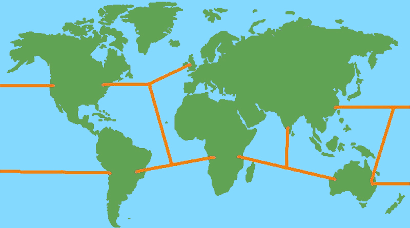
The Earth’s landmasses and natural nautical trade routes
Unlike the boundaries of countries, the boundaries of landmasses, where land meets sea, for most extents and purposes never change. They are therefore entirely dependable. When you learn about the shapes and position of Earth's continents, you can be sure the information stored in your brain won't go out of date.
Futhermore, humanity has no power over the shapes of landmasses, so you can be sure you aren't being fed propagranda or getting brainwashed or even just being given someone else's opinion. Learning about landmasses, and science and nature too, is a calming break from people and their necessity to put an emotional 'spin' on everything. Just the facts, Jack.
Anyway, let's get to the point of this post, which is, to look at Earth's landmasses and to discover natural nautical trade routes.
Here is the simplist image of the world map I could find.

Because we're used to seeing it so often, let's change the world map by flipping it upside-down. Note that doing this will fundamentally keep it the same though.

From this upside-down view, the world looks renew to me. I can see that Europe and Asia are practically one huge continent, that South America looks like a slightly smaller version of Africa (which is seemingly hanging by a thread to to Asia - ditto with S. and N. America), Greenland should have a right to be it's own continent as it's bigger than Australia, there is a remarkably clear channel straight from Greenland to the Arctic (part of which we've called the Atlantic Ocean - and note that the map fails to appreciate the Pacific Ocean).
Sea trade is cheaper than land trade (because friction is less of a problem) and is therefore more important. Let's have a look at some obvious sea trade routes.

The UK is a good place to start, because I live there. From the UK you can fairly easily reach the Americas and Africa. It's difficult to reach Asia and Australia though - the best route would be to sail around Cape Town at the south of Africa. Perhaps you could use the seas of northern Russia to reach China and India, but then again the journey looks unnecessarily long when you can just go around Africa. (As a side note, perhaps Cape Town is famous as a place for ships to rest and resupply?)
From Japan or China, you can easily reach Australia, and probably Africa if you sailed through the various islands of the Phillipines. The Americas would be a long and perhaps perilous journey because of the huge size of the Pacific Ocean.
The image shows that Eurasia, the Americas, and to a much lesser extent Africa are basically large obstacles for seafaring. If they were a set of smaller islands instead, like Australasia, then they could be sailed between.
The thin strips of land connecting Africa and and Asia, and North and South America, look like candidates for huge canals. While the construction of such canals would be a huge project, the time saved on sea journeys might make it worthwhile.
Of course, the Suez and Panama Canals already exist and serve this purpose:


Leave a comment